

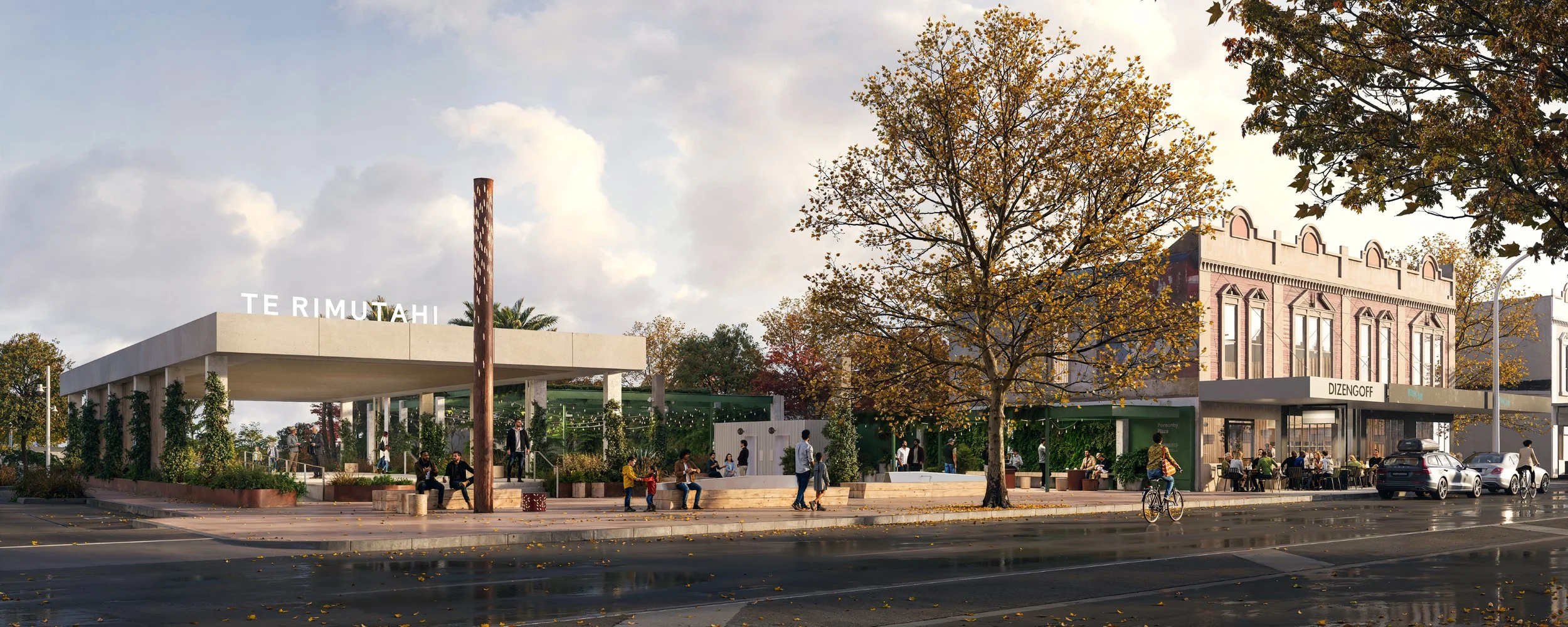
TE RIMUTAHI
-36°51'04"S 174°44'39"E_ Ponsonby_ Tāmaki Makaurau - Auckland_
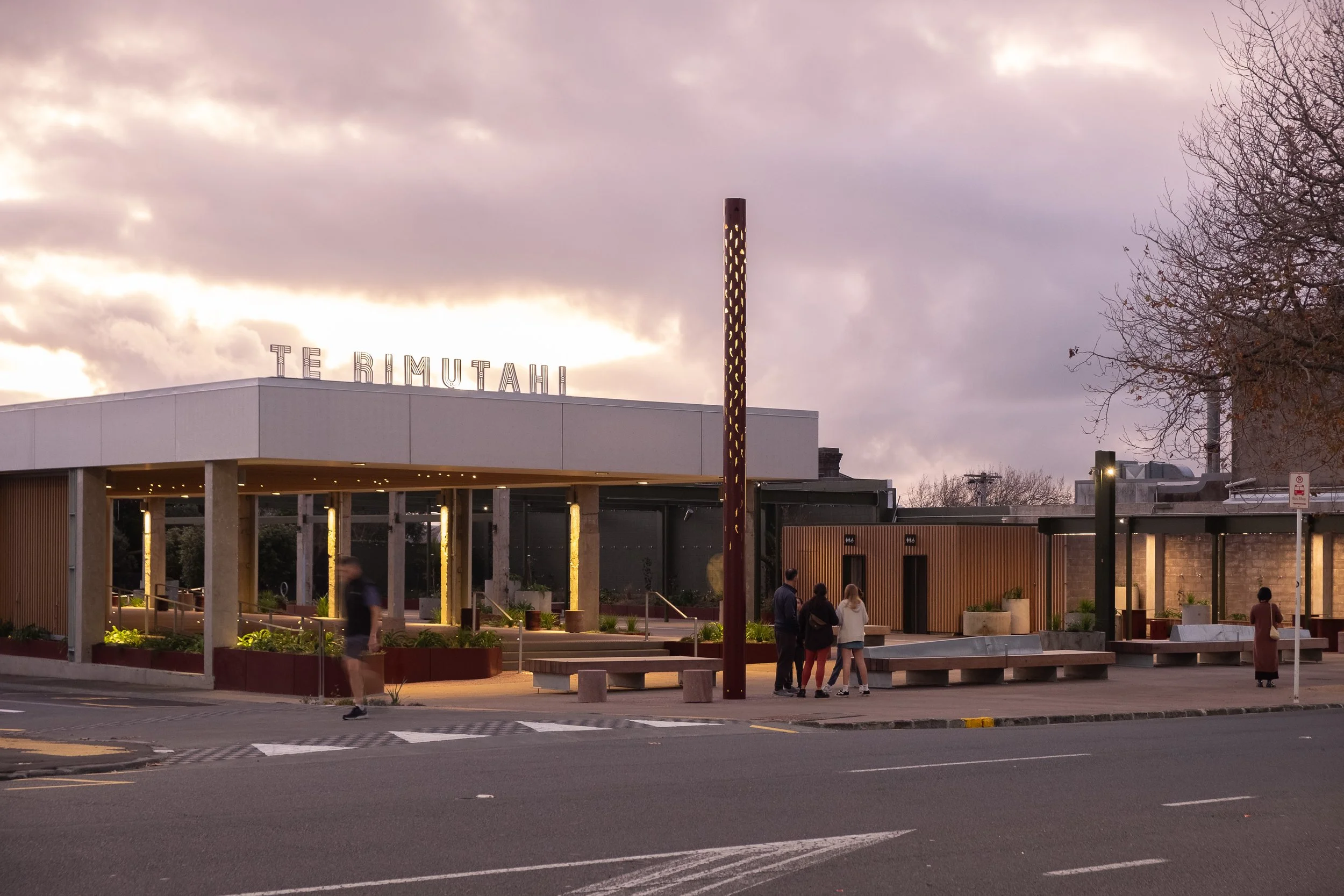
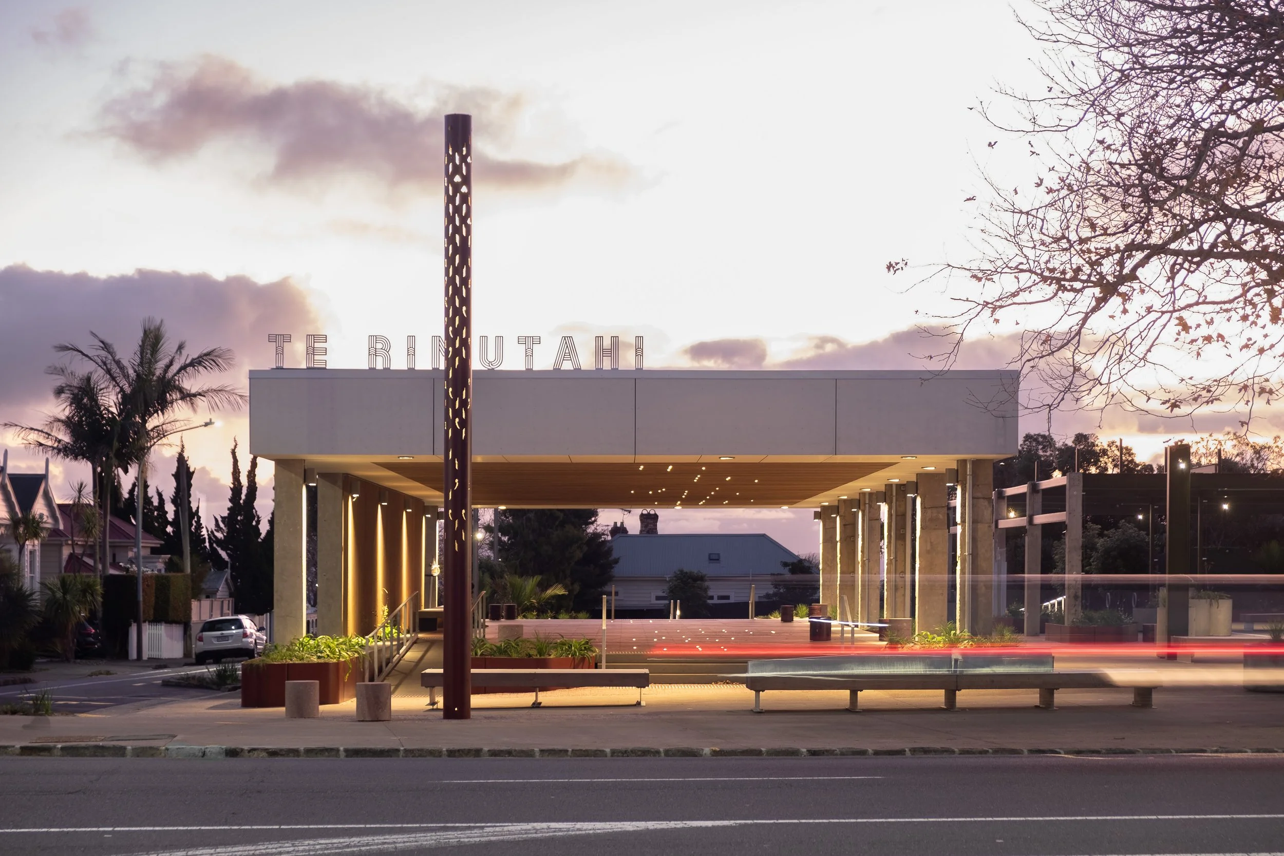
Our vision for Te Rimutahi involved sensitively and adaptively re-using the site’s existing building structures and features to create a unique, hybrid open space and destination that captures the urbanity, spirit and sense of place of Ponsonby.
In a world with increasingly complex problems, collaboration is essential. Te Rimutahi was LandLAB’s winning entry into the Ponsonby Park design competition held in late 2017. This project pilots a new model for community led engagement, a design led process and interdisciplinary collaboration beyond a 'business as usual' consultation process.
Ponsonby is a place of continuous transformation, re-inventing and re-discovering itself through its rich layers of natural, cultural and social history. Our aspiration is for this site was to contribute to this dynamic and on-going re-invention. Ponsonby is inclusive, Te Rimutahi will reflect contemporary values of democracy, inclusiveness and sustainability through a simple, but rich, sequence of interwoven internal and external public spaces. Ponsonby needs a dynamic new public space, not just a green one, that is strategically located and equipped to simultaneously compliment and counter-balance the street and to emerge overtime via a choreographed program of intervention, occupation and event.
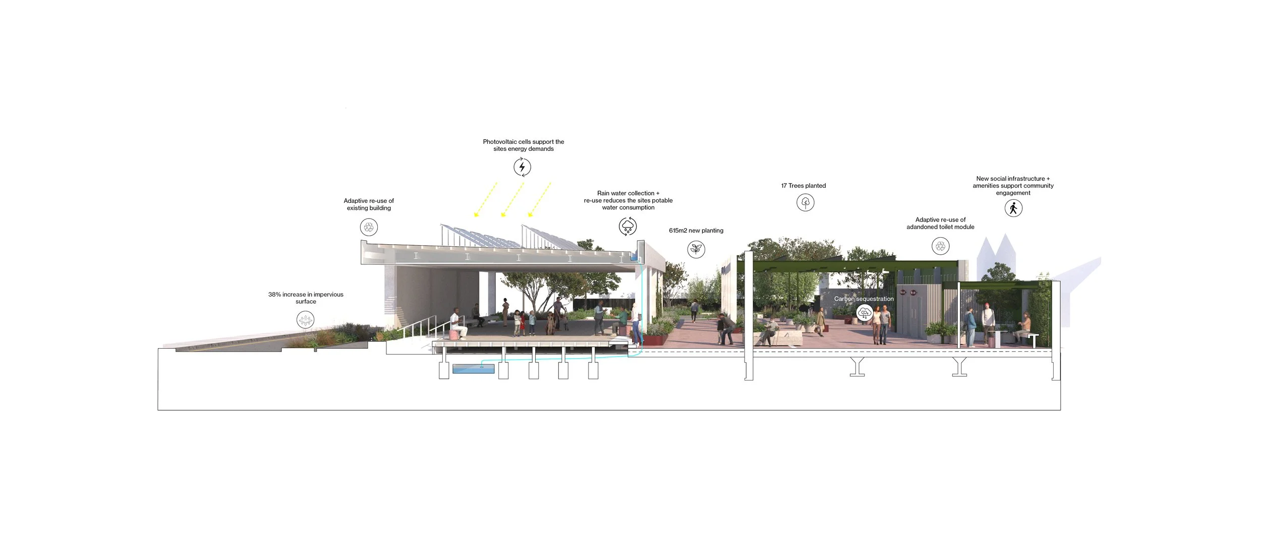
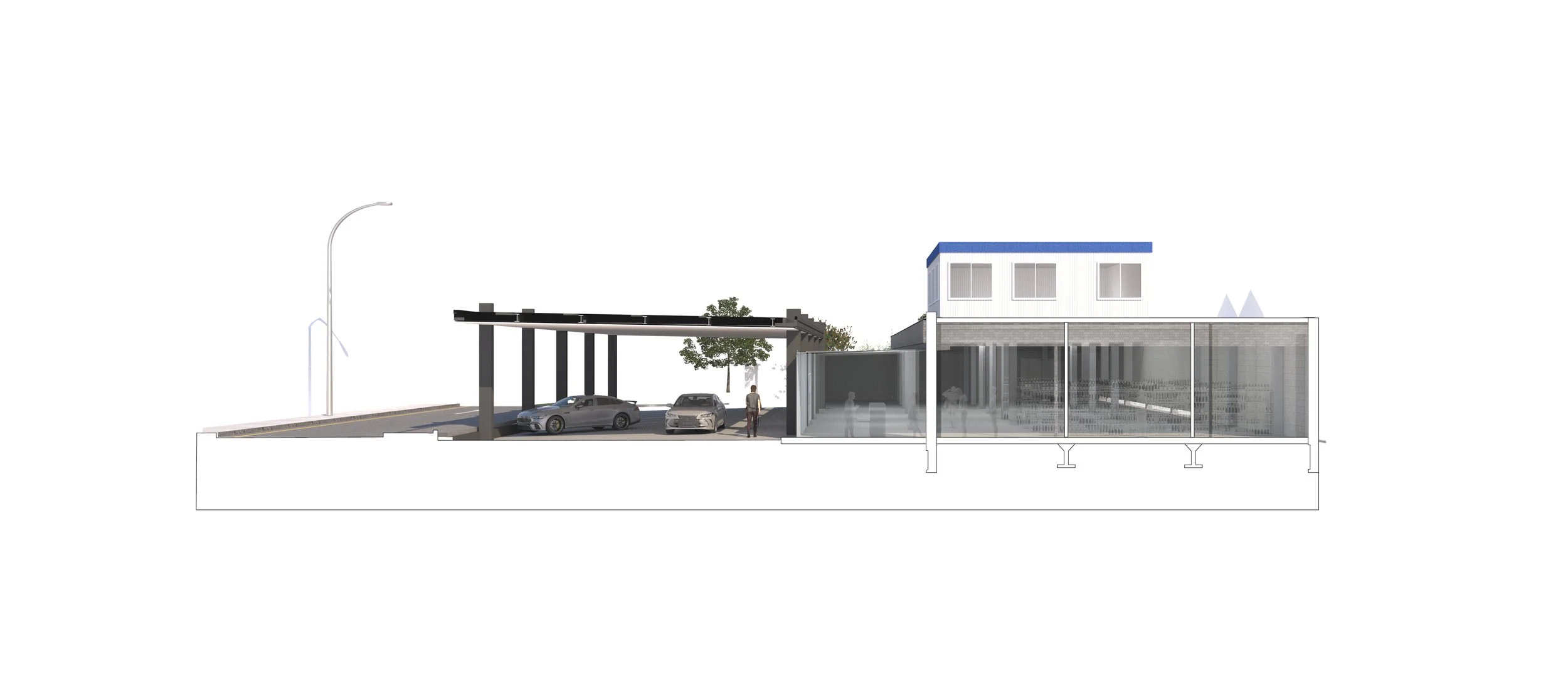
Te Rimutahi weaves together the street (urban) and park (green) to re-program the site through the fluid interaction of open space, architecture, community and place. The plaza embodies Ponsonby through innovative remediation, storm water filtration/re-use, sustainable energy generation, rich materiality, design excellence and creative place making that demonstrates best practice in environmental, cultural and social sustainability.


The name ‘Te Rimutahi ‘was gifted for this site by Ngāti Whātua Ōrākei. Te Rimutahi was ‘The Lone Rimu’, a sacred tree that once stood where Ponsonby and Karangahape Roads intersect today.
Te Rimutahi also refers to the Ponsonby ridgeline, a traditional Māori walking track from Maungawhau / Eden through Te Uru Karaka / Newton Gully to the two headland pā sites at Te Oka pā / Pt Erin and Te Tō pā / St Marys Bay. The track was an important route for trading and interactions between people and resources.
Ngāti Whātua Ōrākei collaborated in the development of the design for this civic space.
Te Rimutahi is represented by the vertical marker element creating presence and cultural identity within the street. The Rimu tree has inspired the forms, patterning, textures, ecology and colour palette. The perforation designs are informed by rau (leaves), and the pūrerehua (moth) species Isonomeutis amauropa that are found in Rimu dominated forests. The larvae cocoon themselves under the bark of the tree. The kōrero of the moth symbolises the connection to marama, rimu ecologies and the wider context of the site. In addition to this, a specimen Rimu tree has been introduced within the site’s green park space to the west.
Maungawhau is represented in the garden bed geometry, layering and terracing of the site.
The nearby streams of Waikuta and Tunamau are represented through ground plane patterning reflecting wai (water) movement and by circular inlays.
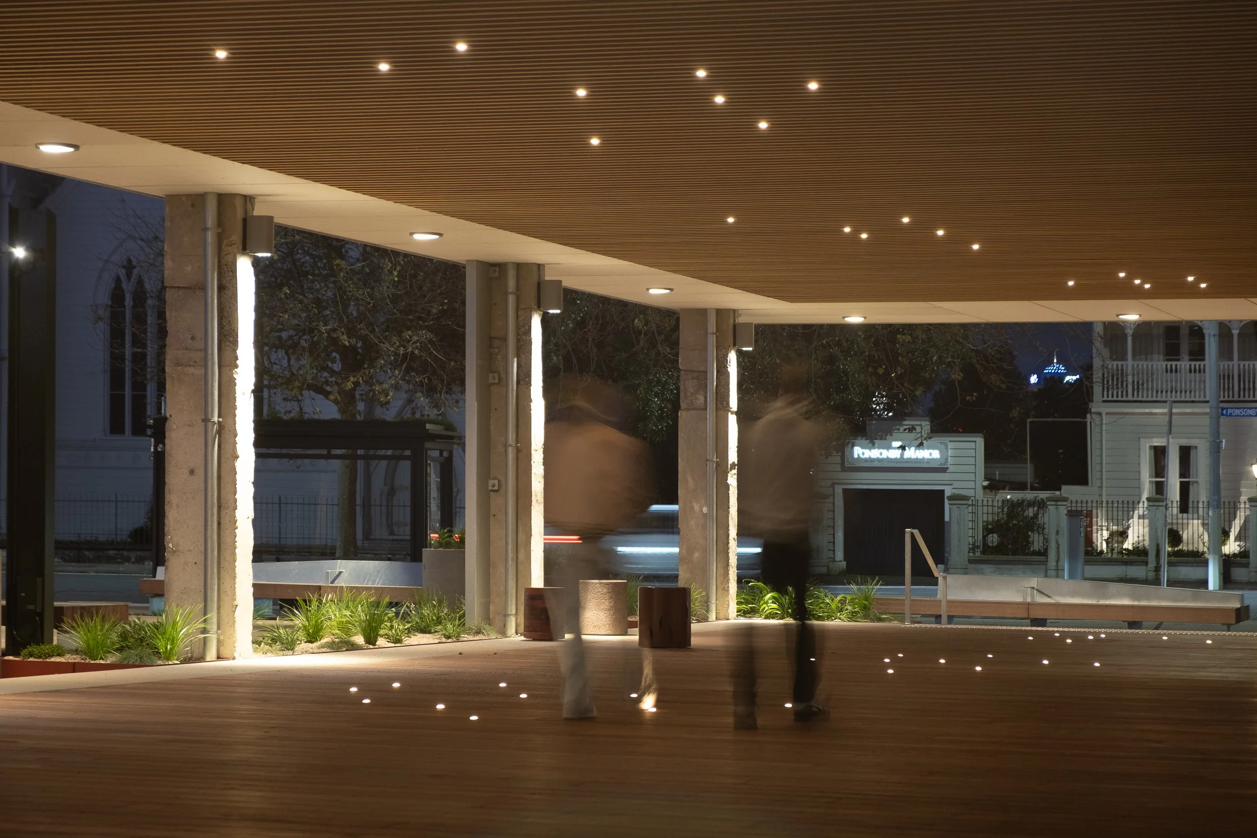
The retained canopy structure provides a wānanga space with ceiling lights representing whetū (stars/constellations) and Ranginui (sky father), with the ground plane lighting reflecting the relationship and connection to Papatūānuku (earth mother).
Details
2017 - Current
Date
254 Ponsonby Road, Tāmaki Makaurau/Auckland, Aotearoa/New Zealand
Location
Auckland City Council (ACC)
Client
Budget
$5.5M
Collaborators
BECA (Civil + Structural + Lighting + Planning)
Mana whenua partners
Graham Tipene
Awards
Designers Institute of New Zealand (DINZ) BEST Awards ‘GOLD’ (2025)
NZILA Award of Excellence in Unbuilt Visionary (2019)
World Architecture News (WAN) Future Projects: Civic Award Winner (2018)
World Architecture Festival (WAF) Civic Future Project Award Finalist (2018)