

Tauranga Moana Waterfront
-37°40'57"S 176°10'17"E_ Tauranga Moana City Centre_ Tauranga_
Reconfiguring the harbour edge as a layered and resilient coastal landscape.
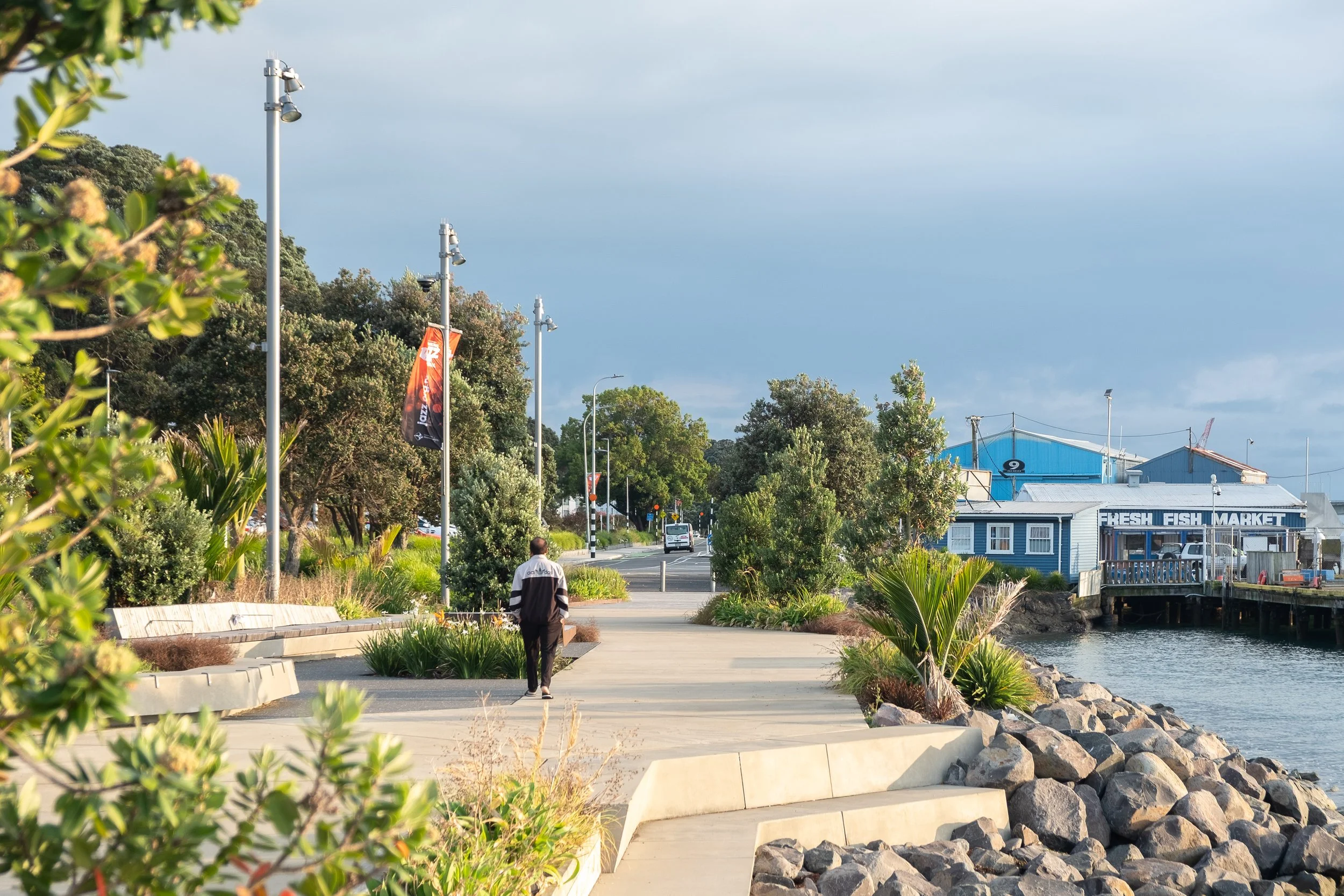
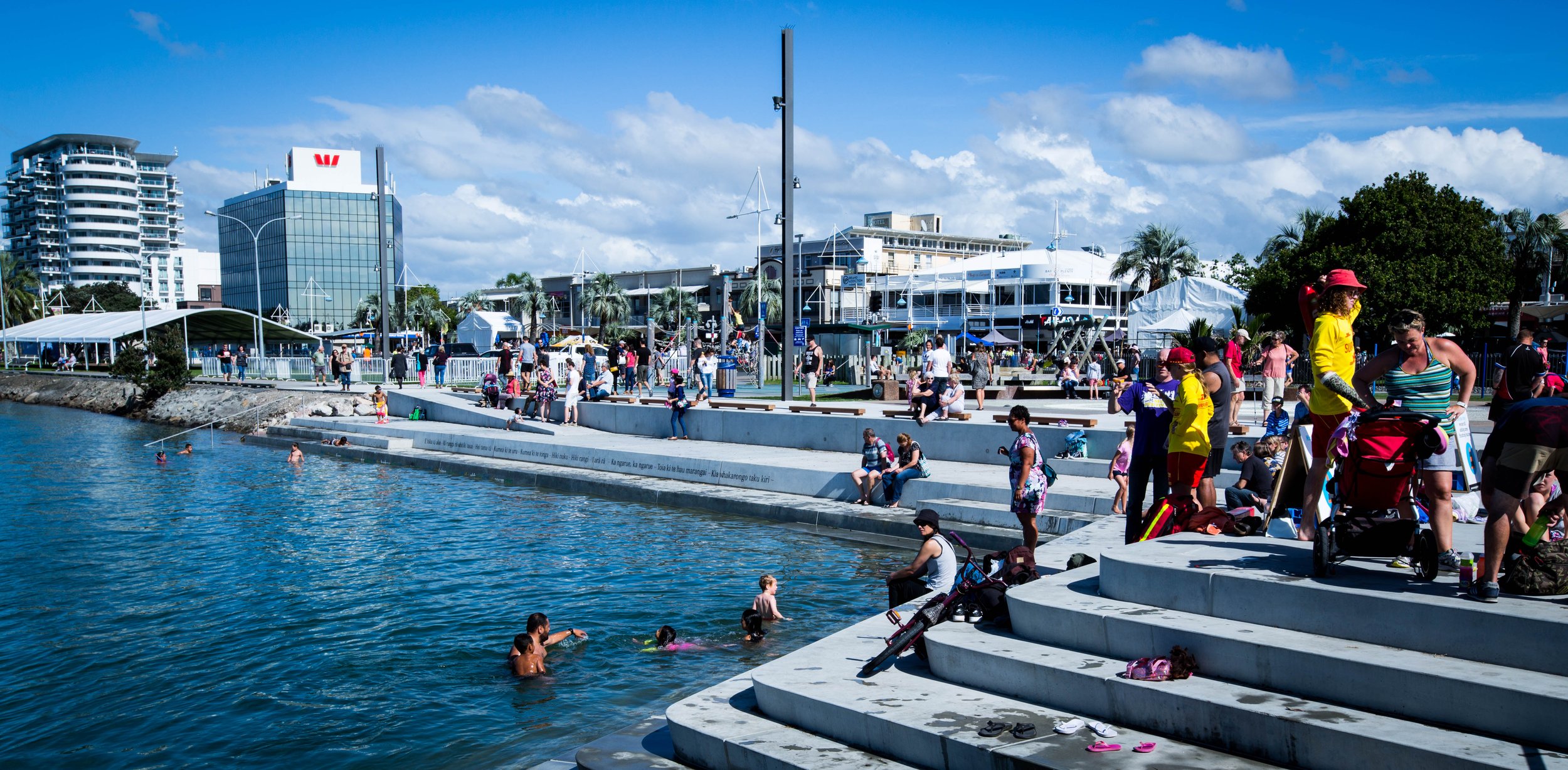
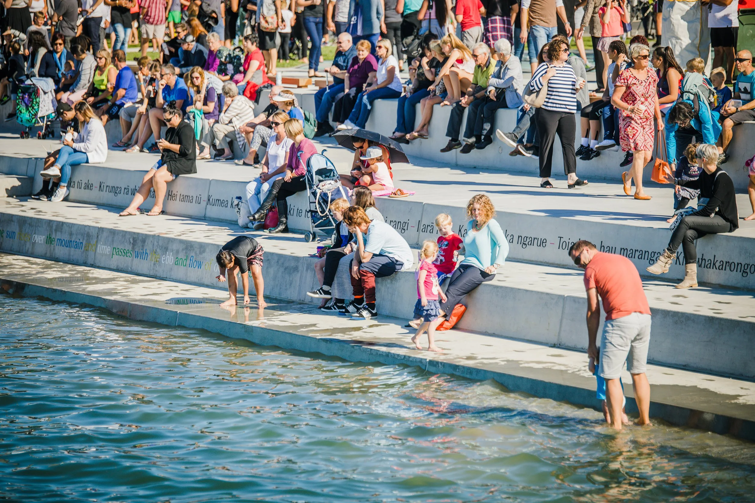
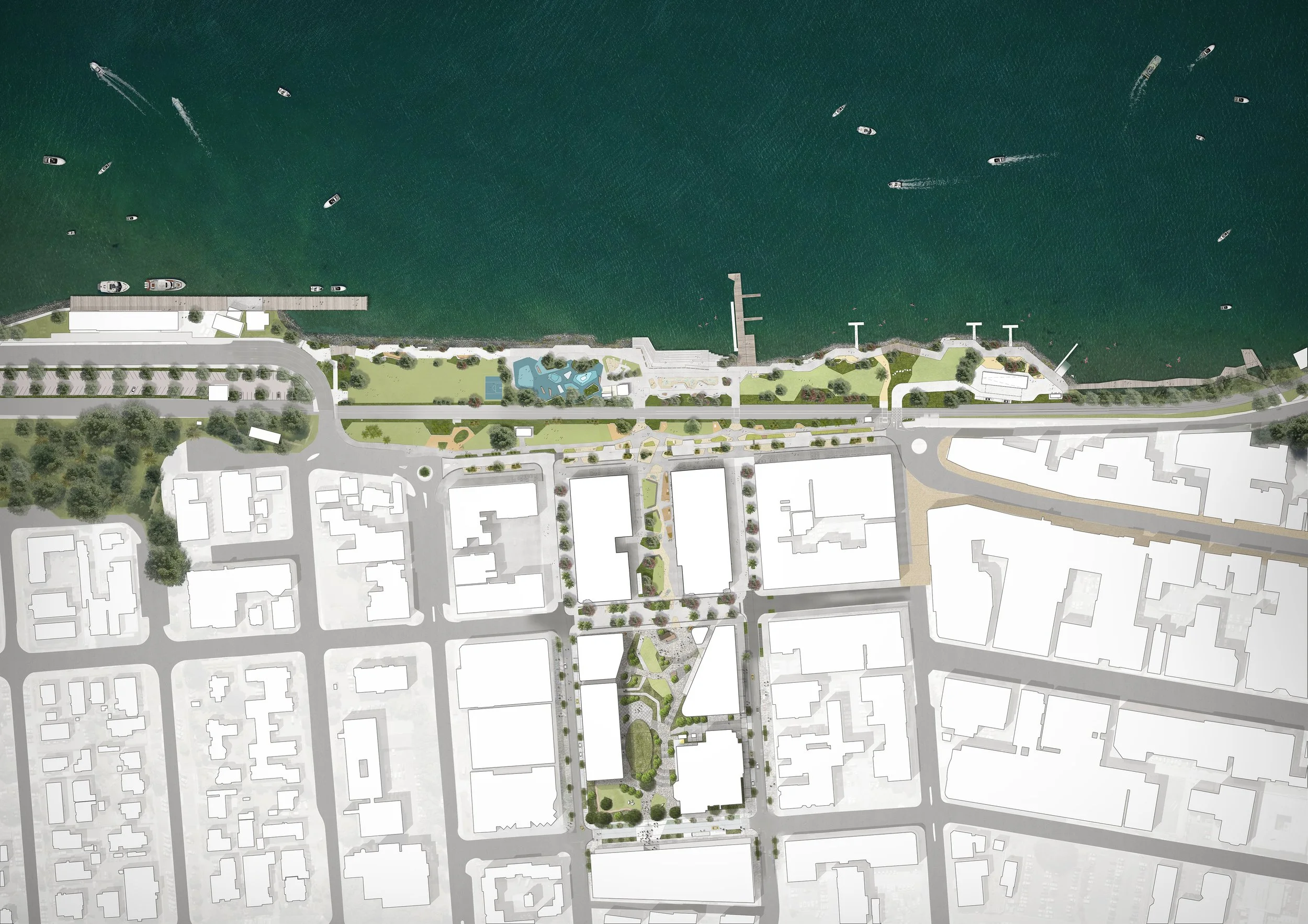
A landscape-led masterplan that reconnects the city centre to Tauranga Harbour. Building on earlier spatial frameworks and civic strategies, the project positions the waterfront as Tauranga’s ‘Landing Place’ - an authentic destination that reveals the deep relationship between whenua (land) and wai (water).
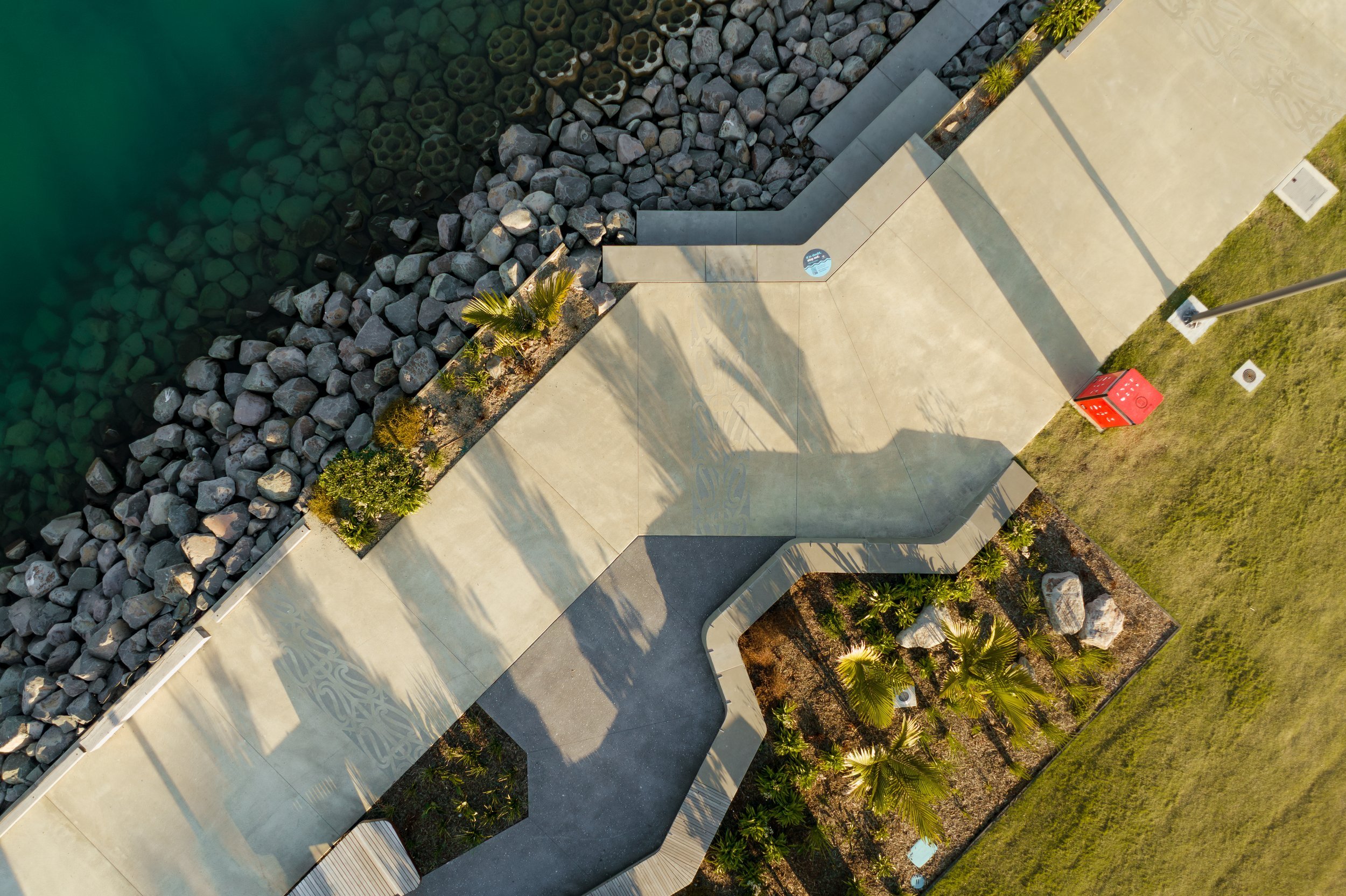
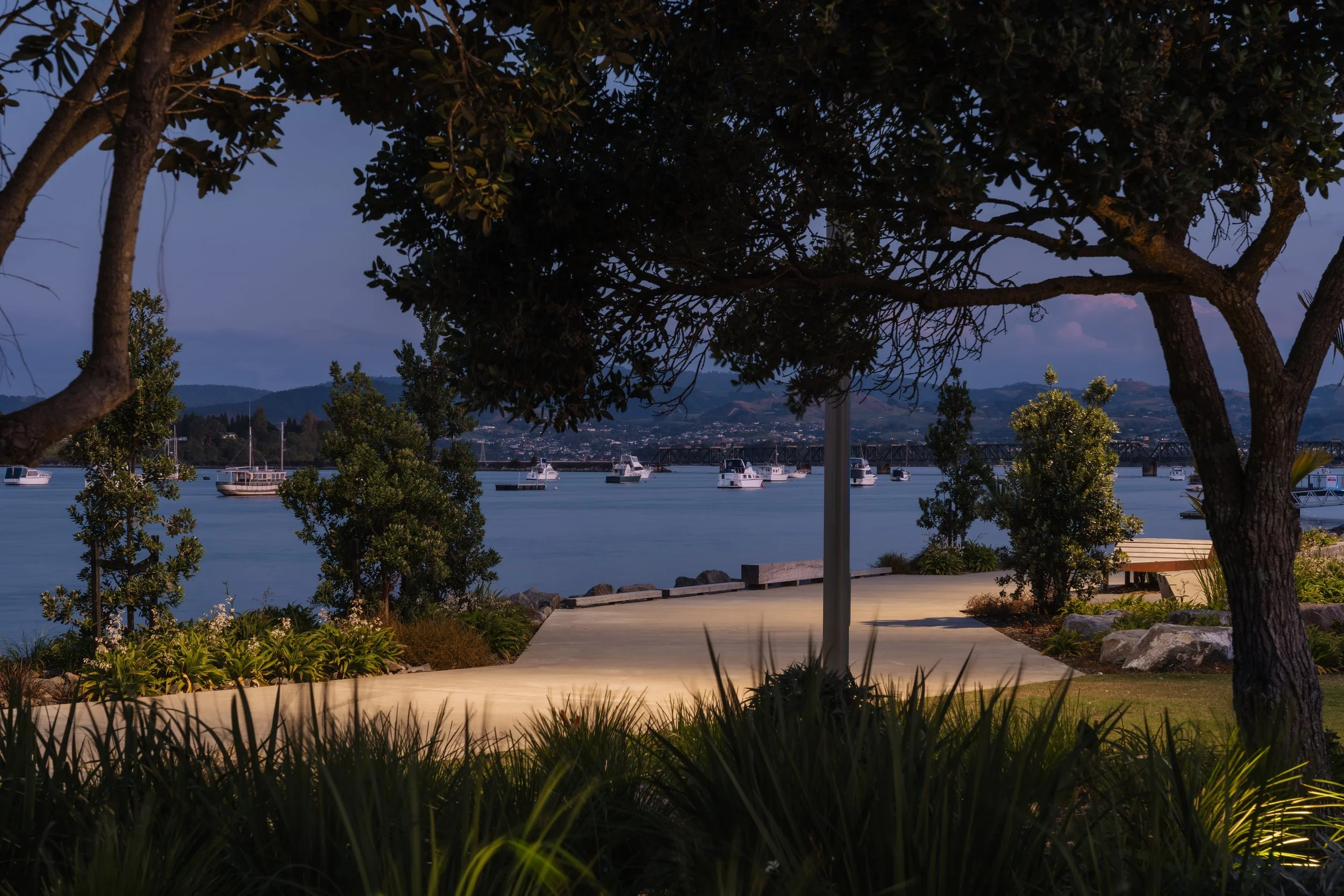
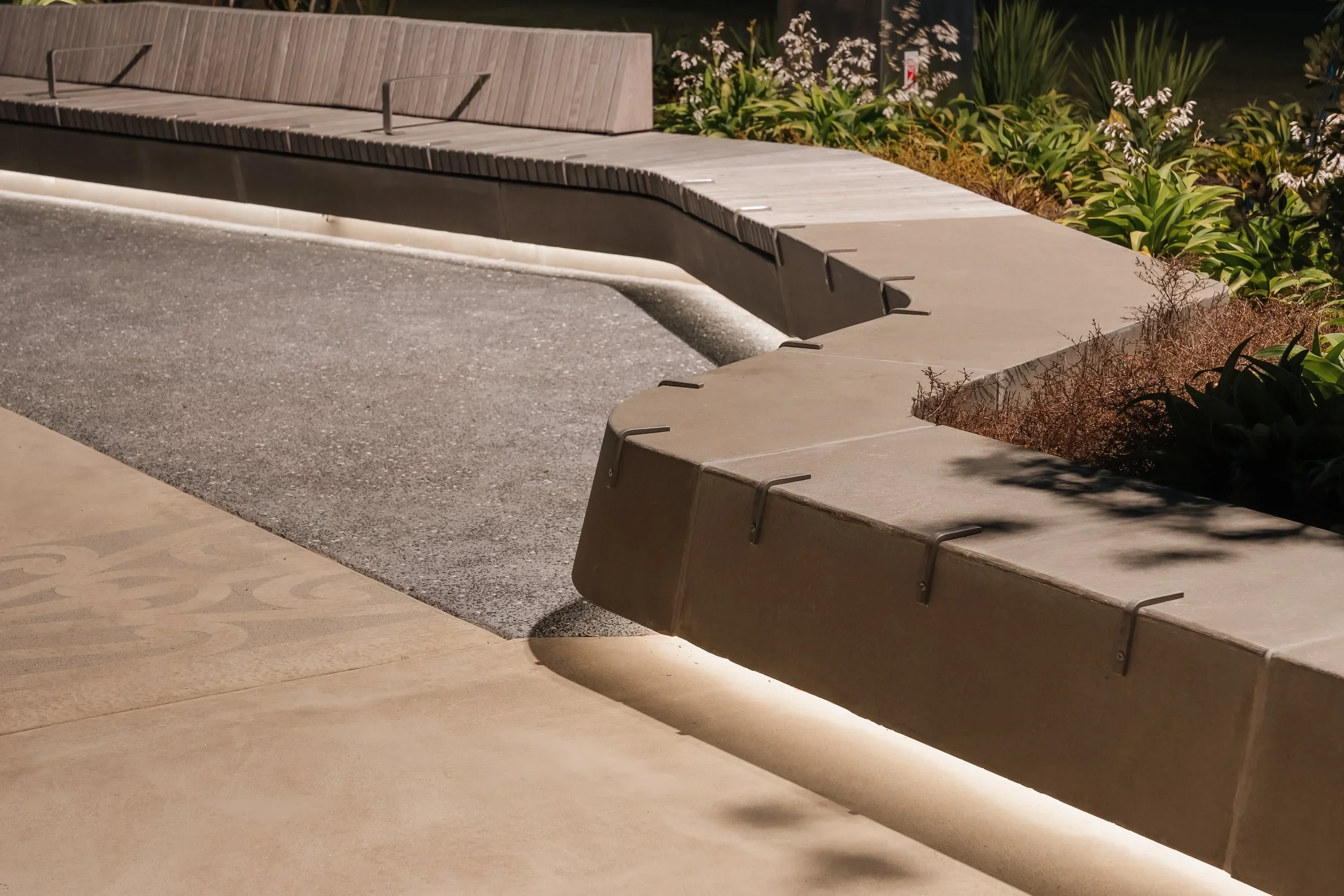
The strategy responds to coastal geomorphology, tidal ecologies and the fine-grain urban morphology of the existing town centre. The low-rise human scale, street grid and working waterfront heritage inform a contemporary reinterpretation of wharves, sheds and high-street typologies. Ecological restoration and climate resilience are embedded within a multi-layered framework that strengthens the coastal margin while enhancing public access.
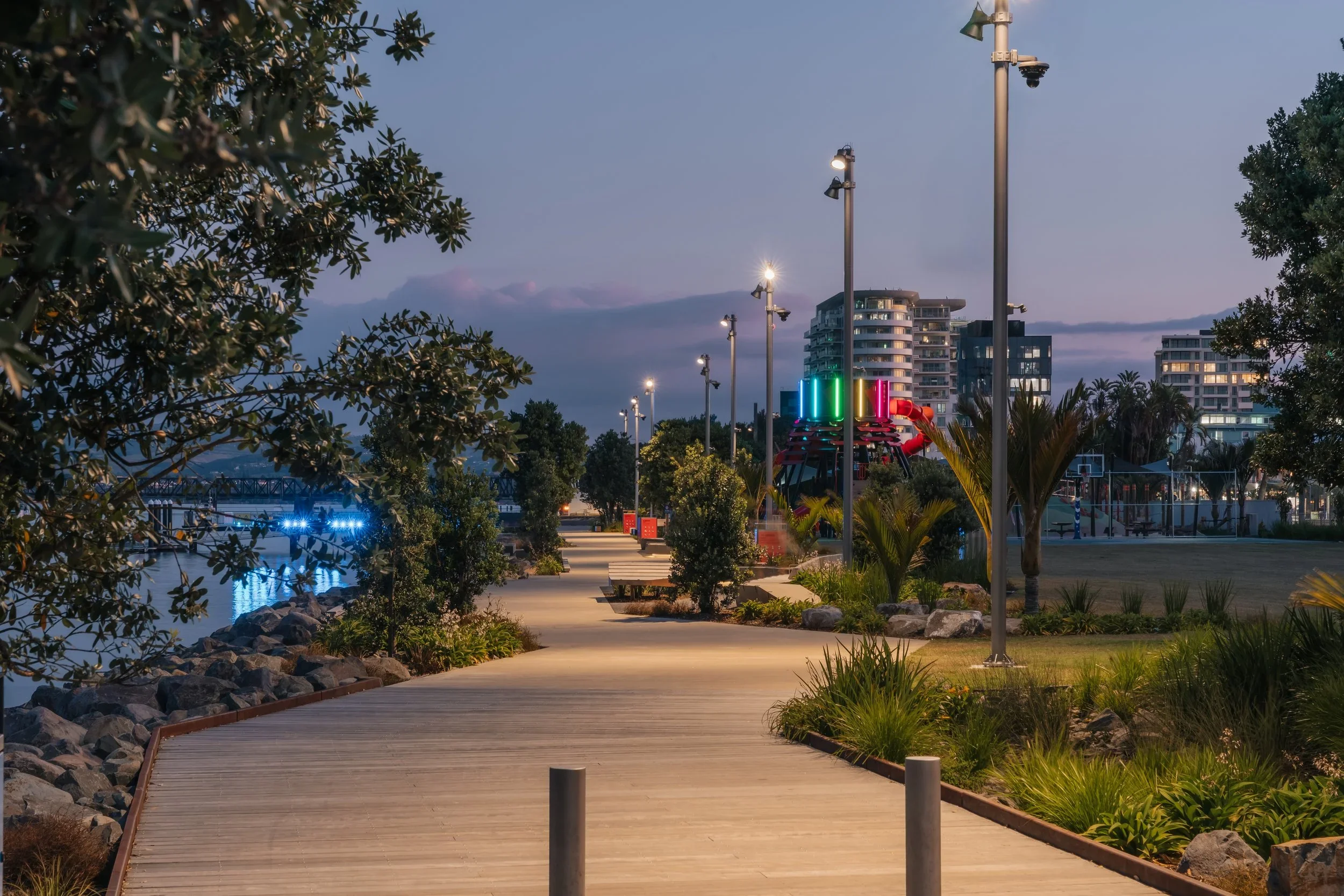
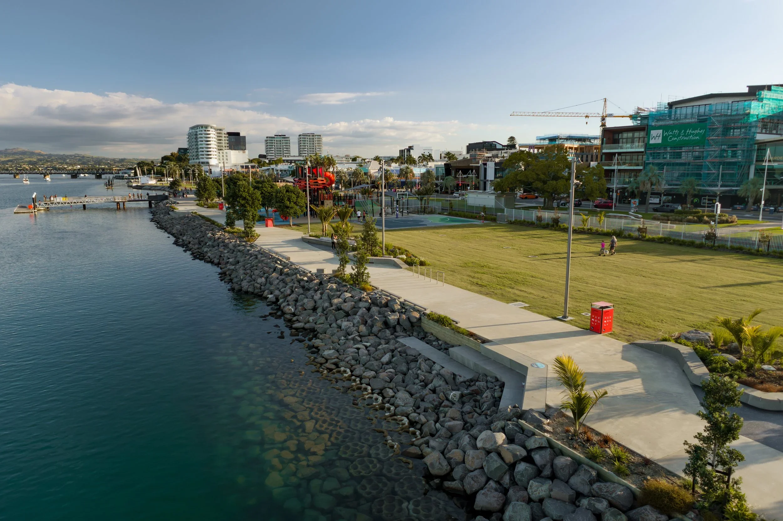
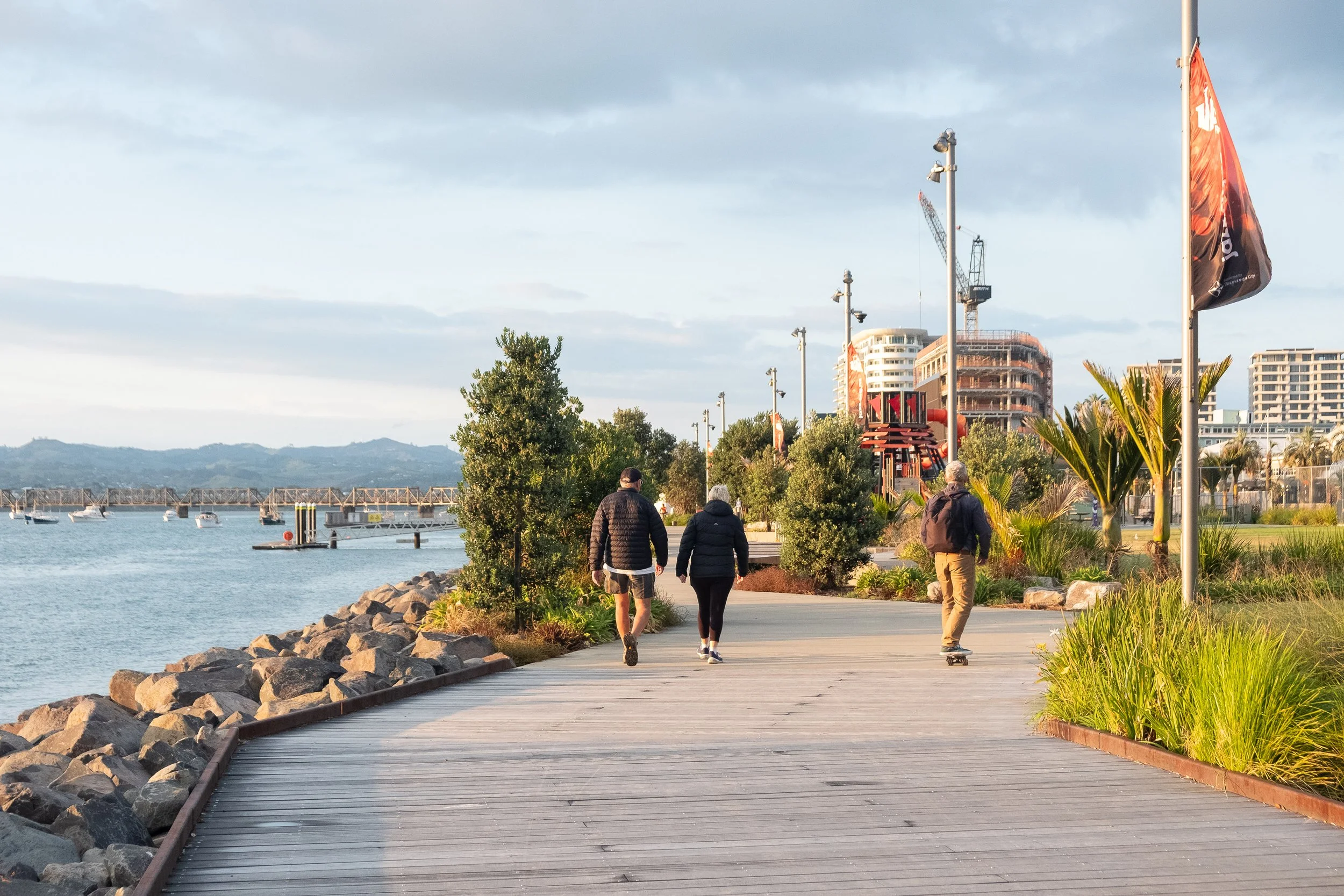
A sequence of connected precincts, promenades and civic spaces articulate the waterfront edge. The central waterfront zone becomes the spiritual and social heart of the city centre — supporting movement, gathering and event programming within a flexible public realm. Layered planting, robust materiality and adaptable infrastructure allow the waterfront to evolve over time through curated activation and community use.
Tauranga Waterfront operates as civic spine, ecological buffer and regional destination. It demonstrates how landscape-led urbanism can align growth, cultural identity and coastal resilience - reinforcing Tauranga’s identity as a contemporary waterfront city.
Stage 001 of this project has been completed (pictured below) with Stages 002 and 003 expected for completion in 2027.

Details
2022 - Current
Date
Tauranga, Aotearoa/New Zealand
Location
Tauranga City Council
Client
Budget
NA
Collaborators
BECA (Civil + Structural + Transport + Coastal)
E3BW (Lighting)
WSP (Coastal Engineering)