

Te Whau Pathway
36°51'49"S 174°39'23"E_ Te Whau River_ Tāmaki Makaurau - Auckland_
Weaving together land, river and community through environmentally responsive infrastructure.
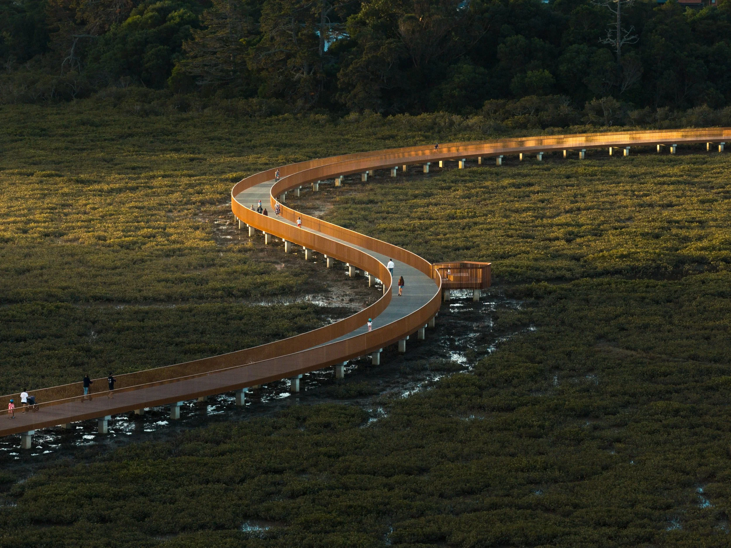
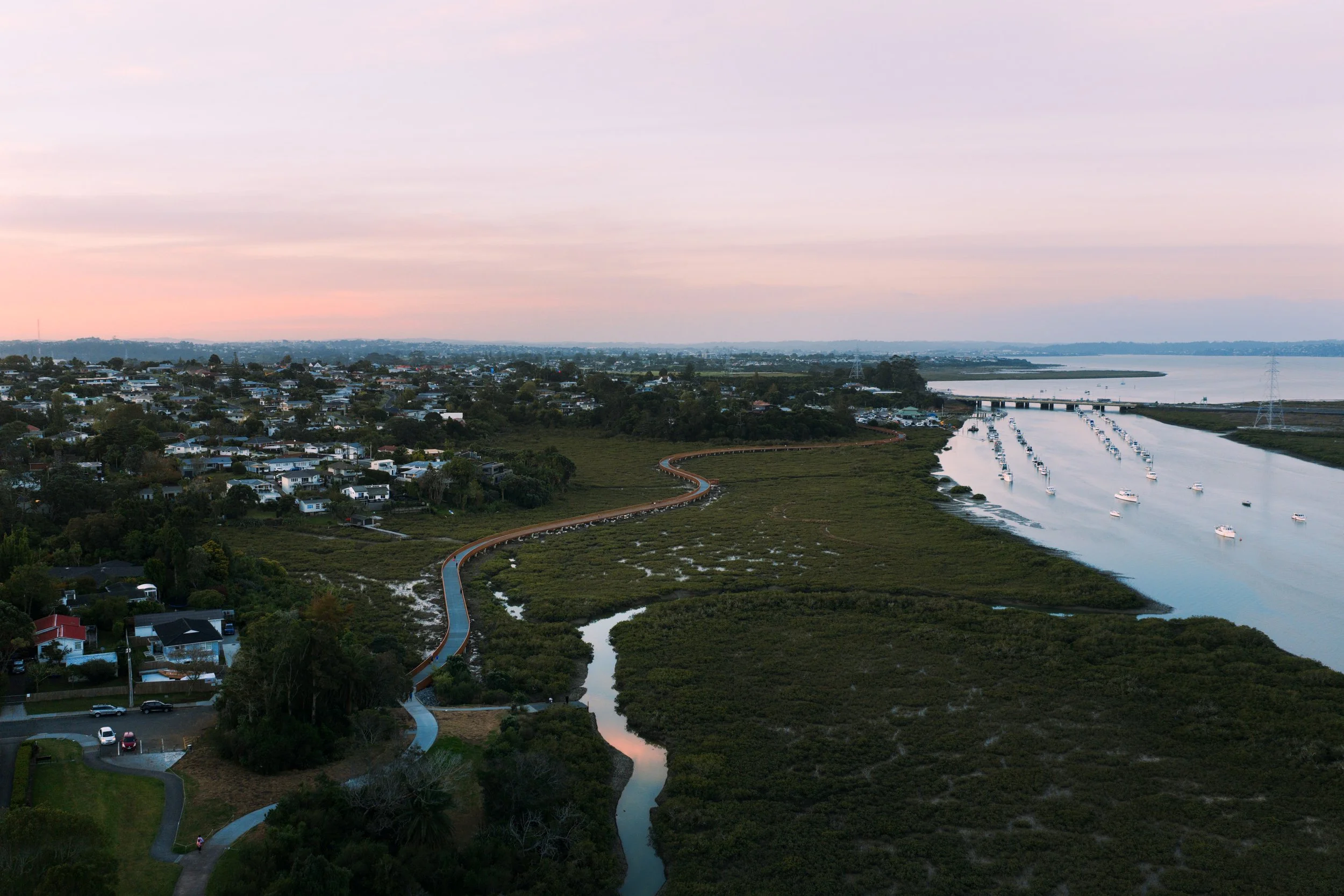
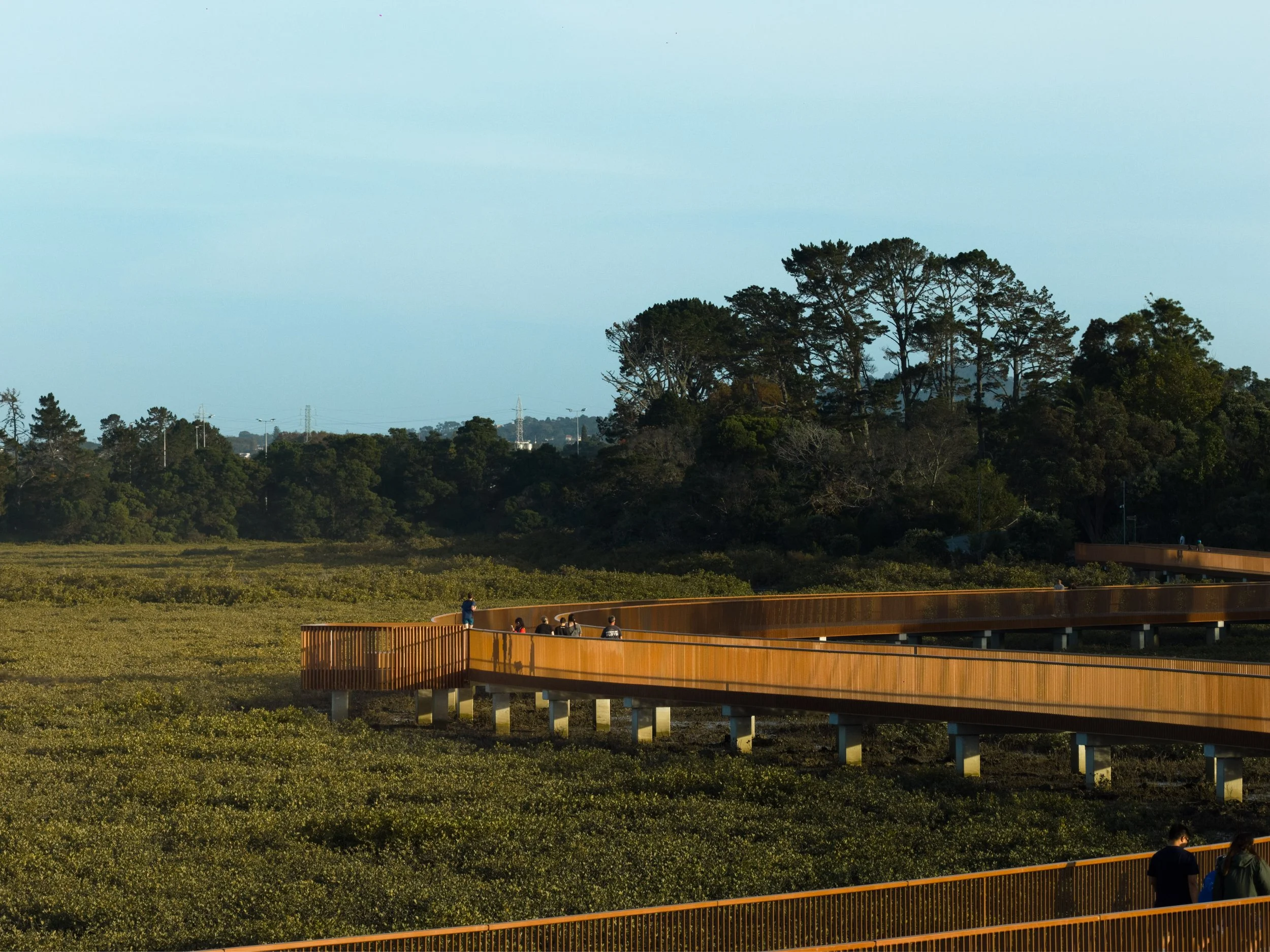
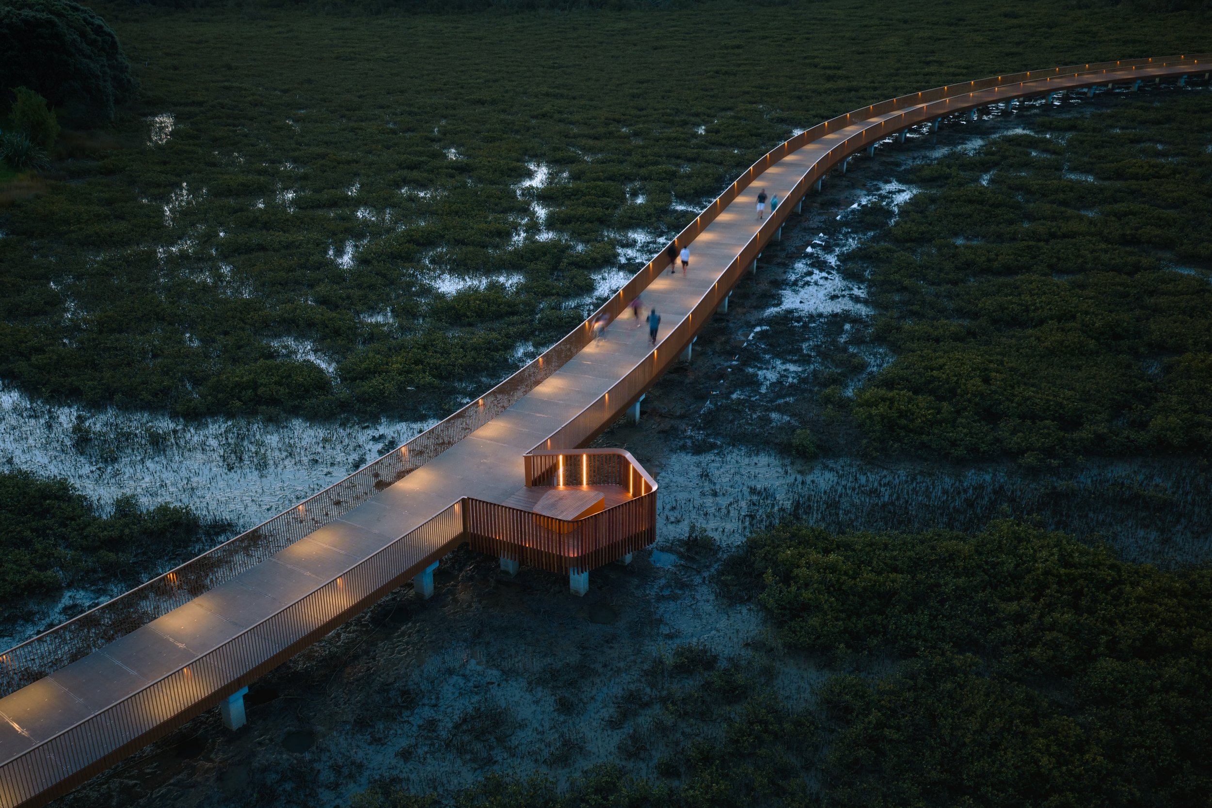
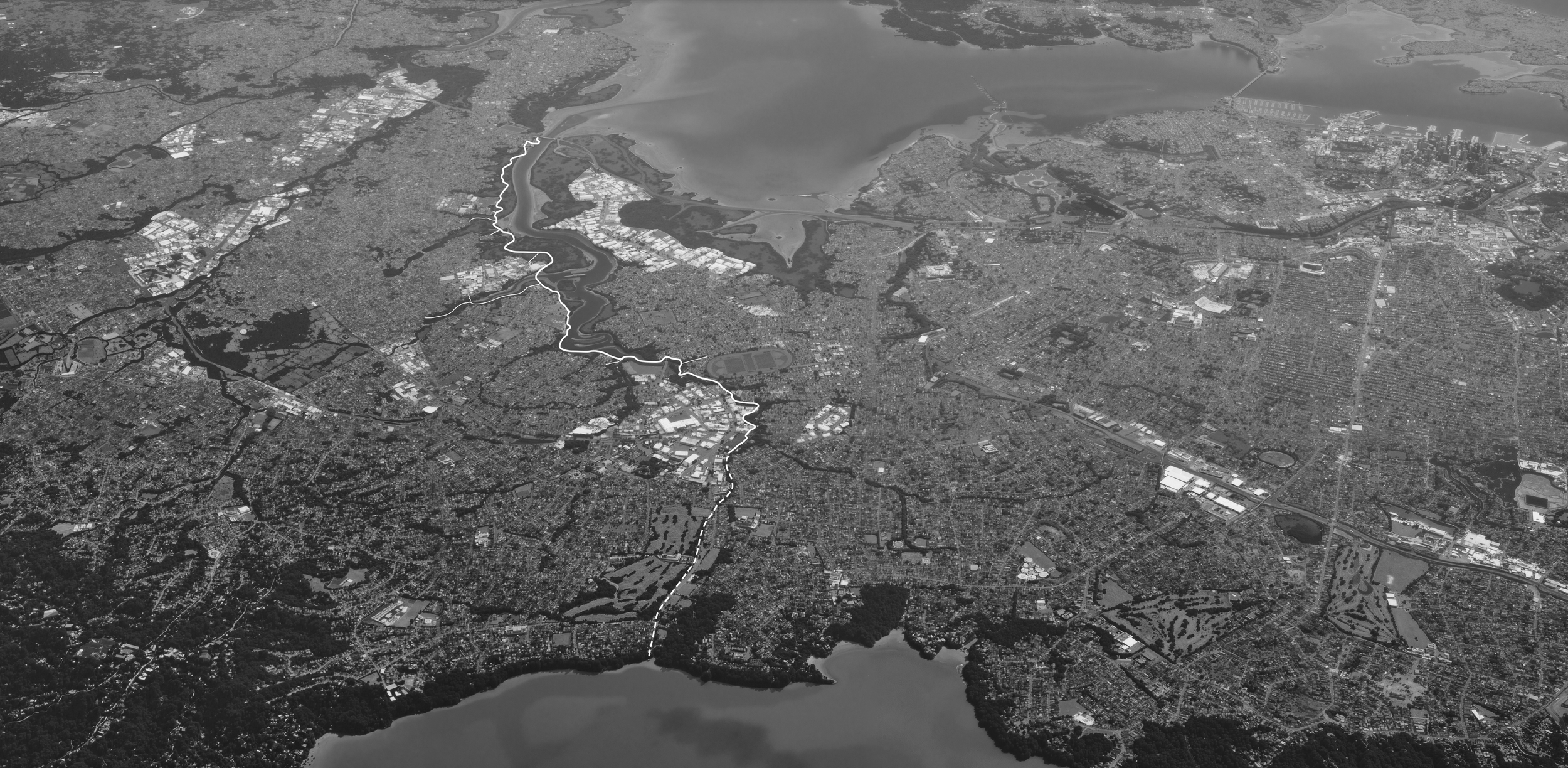
Te Whau Pathway establishes a continuous 6km long walking and cycling corridor along the sensitive estuarine margins of the Te Whau River. More than a transport link, it is civic and ecological infrastructure - reuniting fragmented neighbourhoods with the tidal landscape and reinstating physical connection to the awa (river).
The design responds to the flux and flow of the estuary, mangrove ecologies, tidal gradients and migratory bird habitats. The alignment acknowledges the dynamic nature of the river, positioning the pathway as a light-touch intervention that protects and enhances Te Taiao (the environment) while reconnecting communities long separated from the water’s edge.
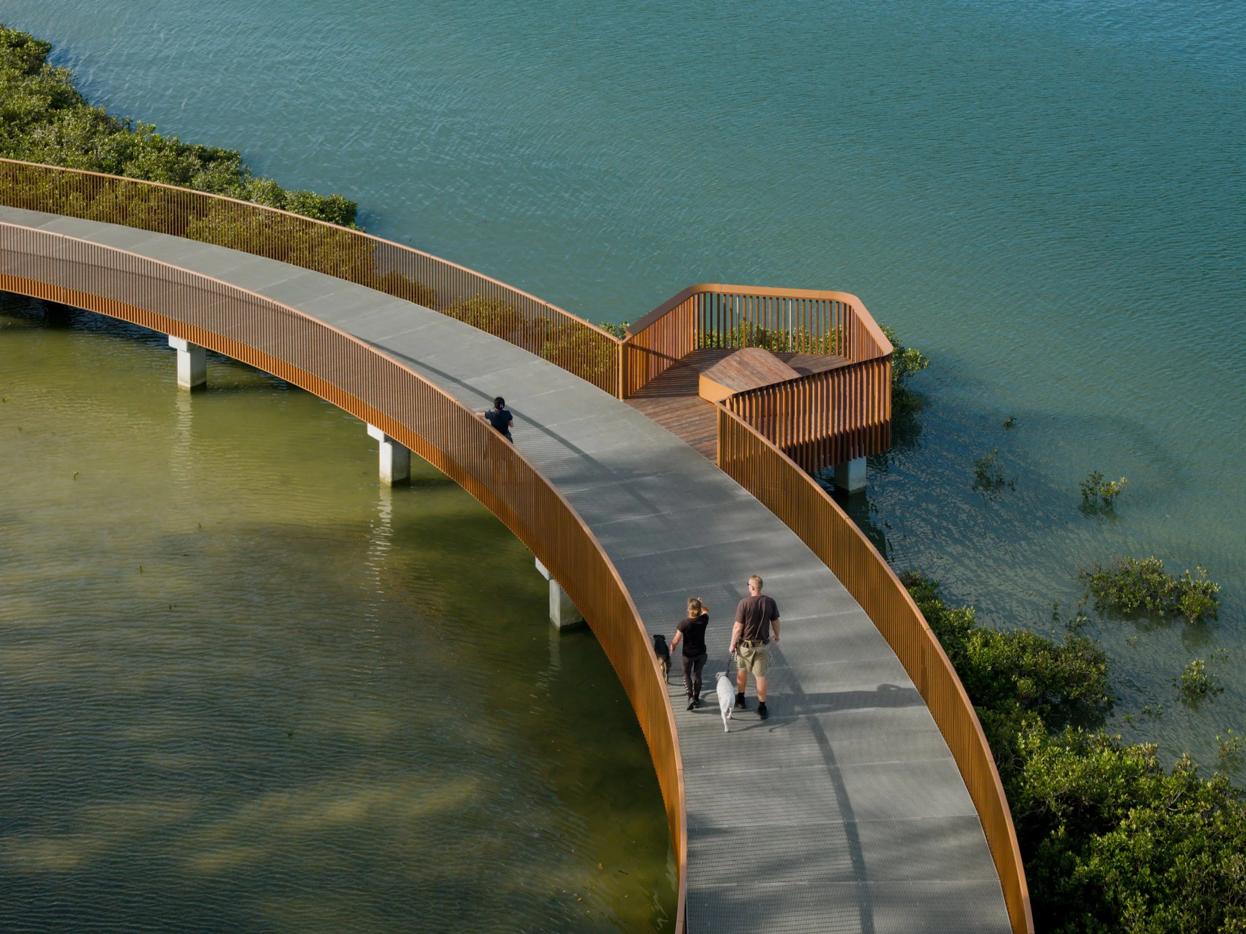
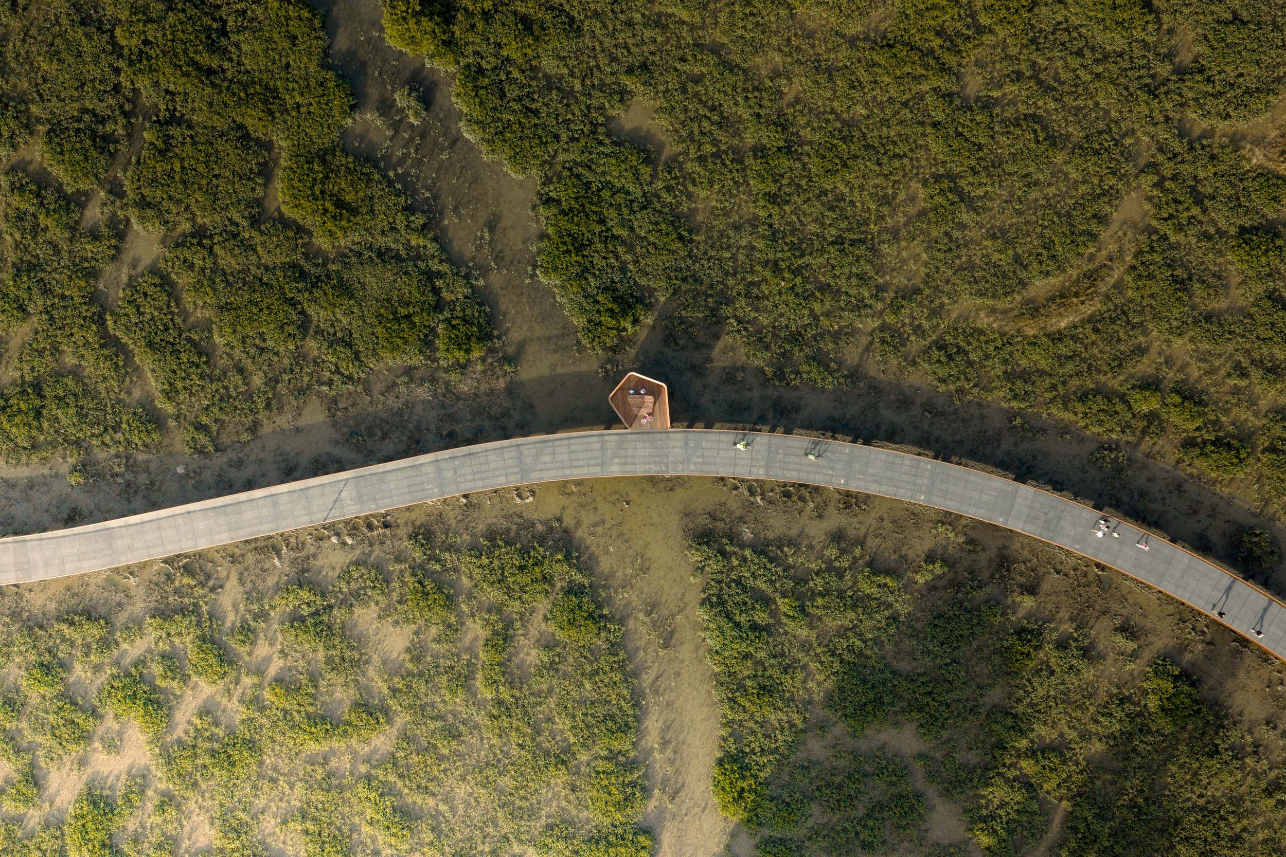
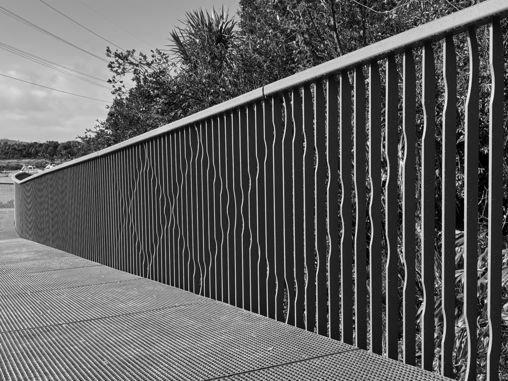
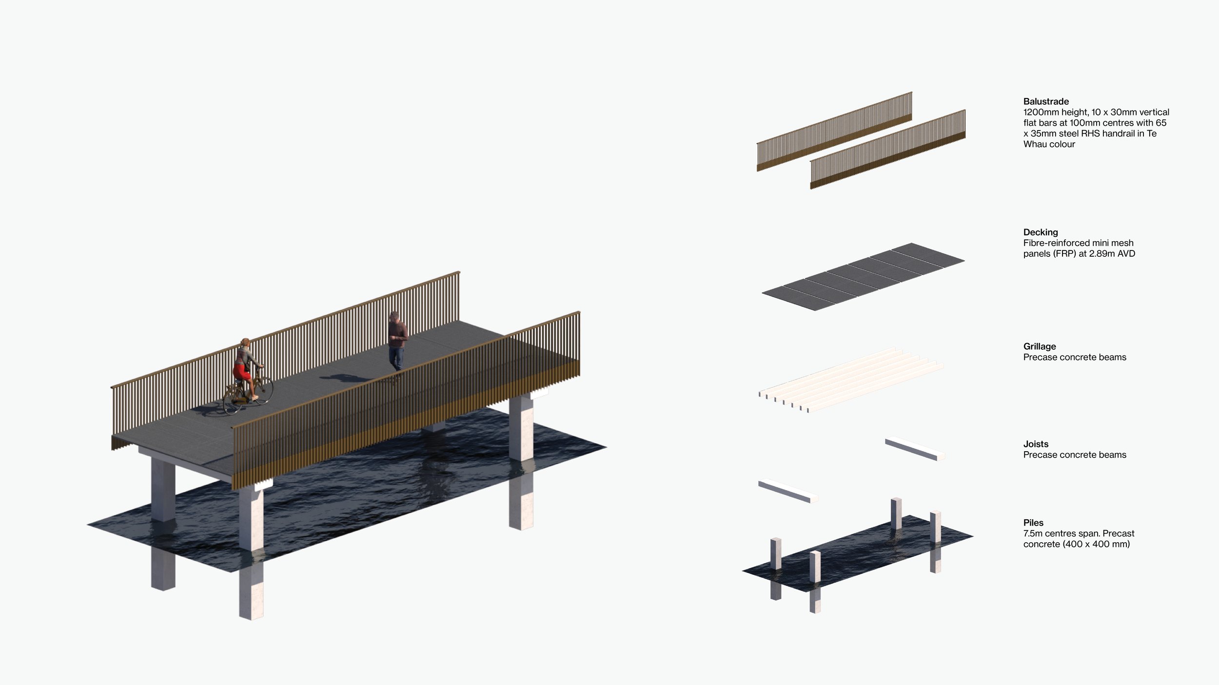
A sinuous and modular boardwalk system weaves between land, estuary and mangroves. Elevated structures minimise ecological impact while appended ‘pods’ create moments for water access, viewing and gathering. On land, nature play elements, seating and wayfinding build a cohesive identity grounded in the colour palette of the intertidal zone and the migratory journey of the kuaka (bar-tailed godwit).
Te Whau Pathway operates as ecological corridor, movement infrastructure and shared community spine. It demonstrates how carefully calibrated design can increase access while strengthening environmental resilience - restoring both mauri and connection along the river’s edge.

Details
2020 - 2026
Date
Te Whau River, Tāmaki Makaurau - Auckland
Location
Auckland Council Auckland Transport Te Whau Pathway Environment Trust
Client
Budget
$30m (Stage 001)
Collaborators
BECA (Civil/Structural) Switch (Lighting) Mana whenua HEB (Contractor)