

Red Hills Masterplan
-36.8214∘S, 174.6114 E_ Red Hills_ Tāmaki Makaurau - Auckland_
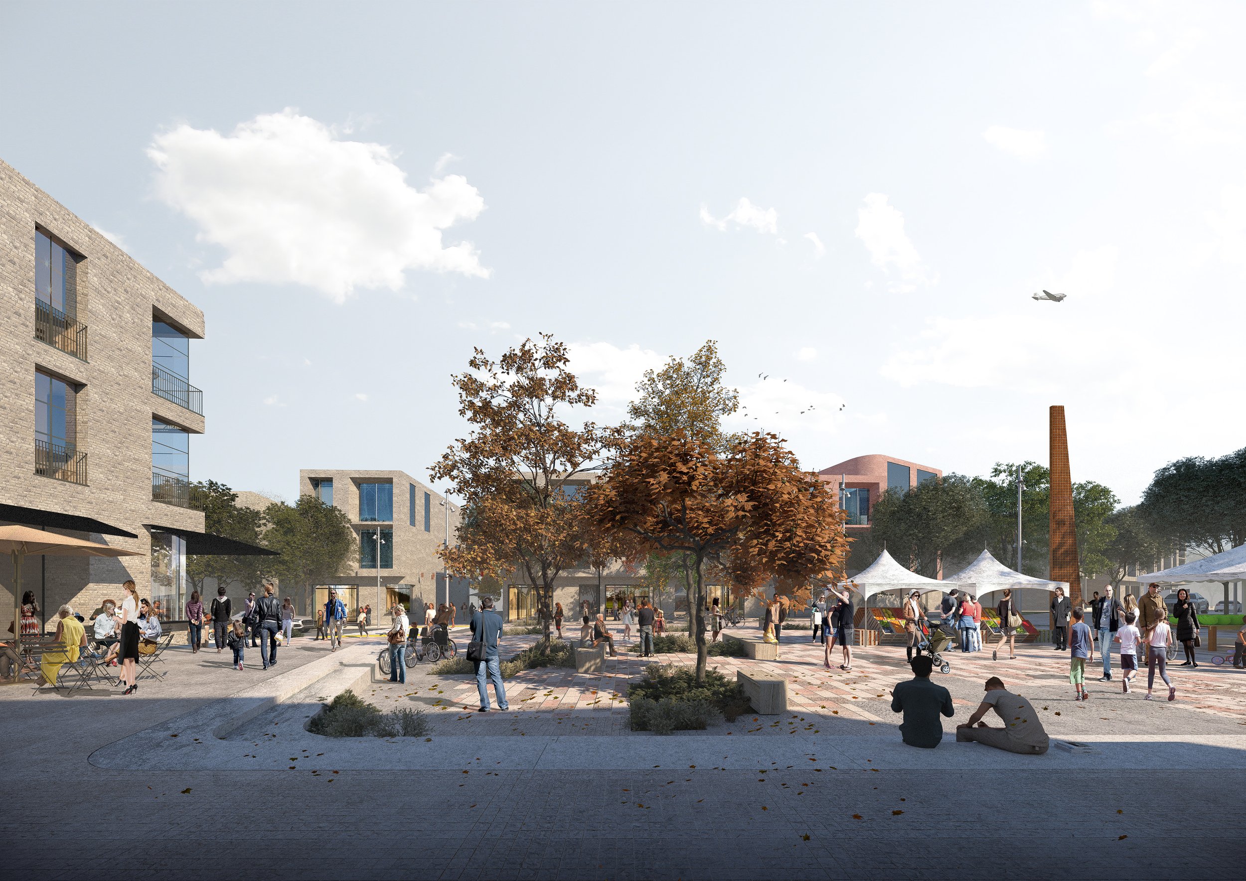
A landscape-led framework structuring a new compact village community.
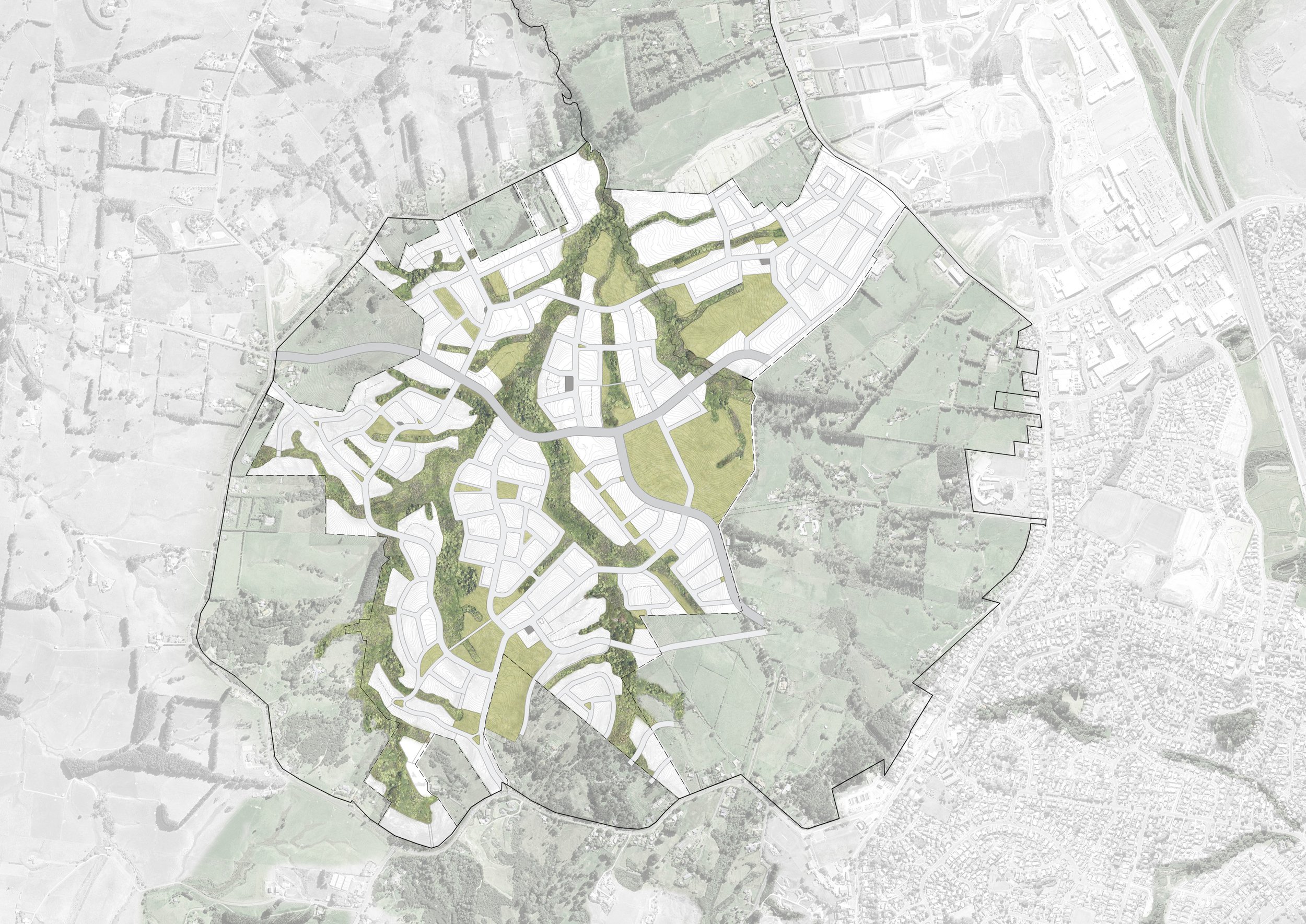
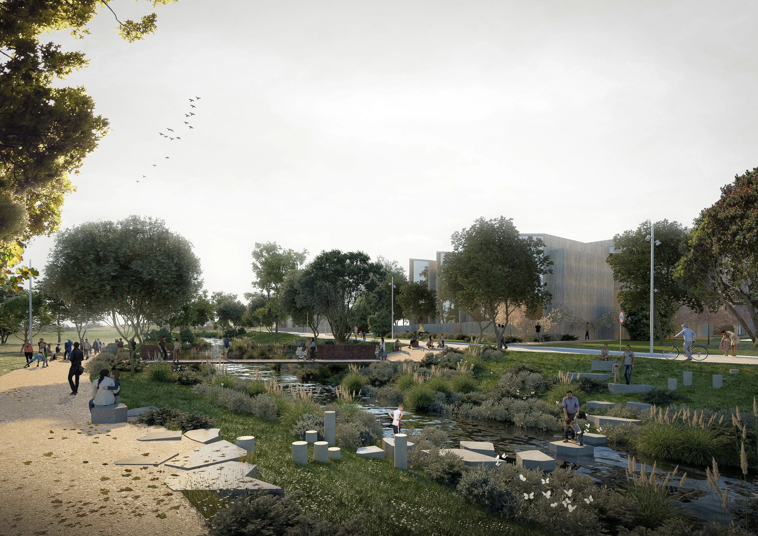
Red Hills is a 50-hectare peri-urban masterplan that positions four urban villages within a compact, walkable and landscape-led strategy. The framework is informed by a landscape-first response that retains and expands an existing network of stream corridors connecting the site to the wider Te Waitematā catchment. These ecological corridors form the spatial armature of the community - establishing green infrastructure and public realm as the foundation of urban form.
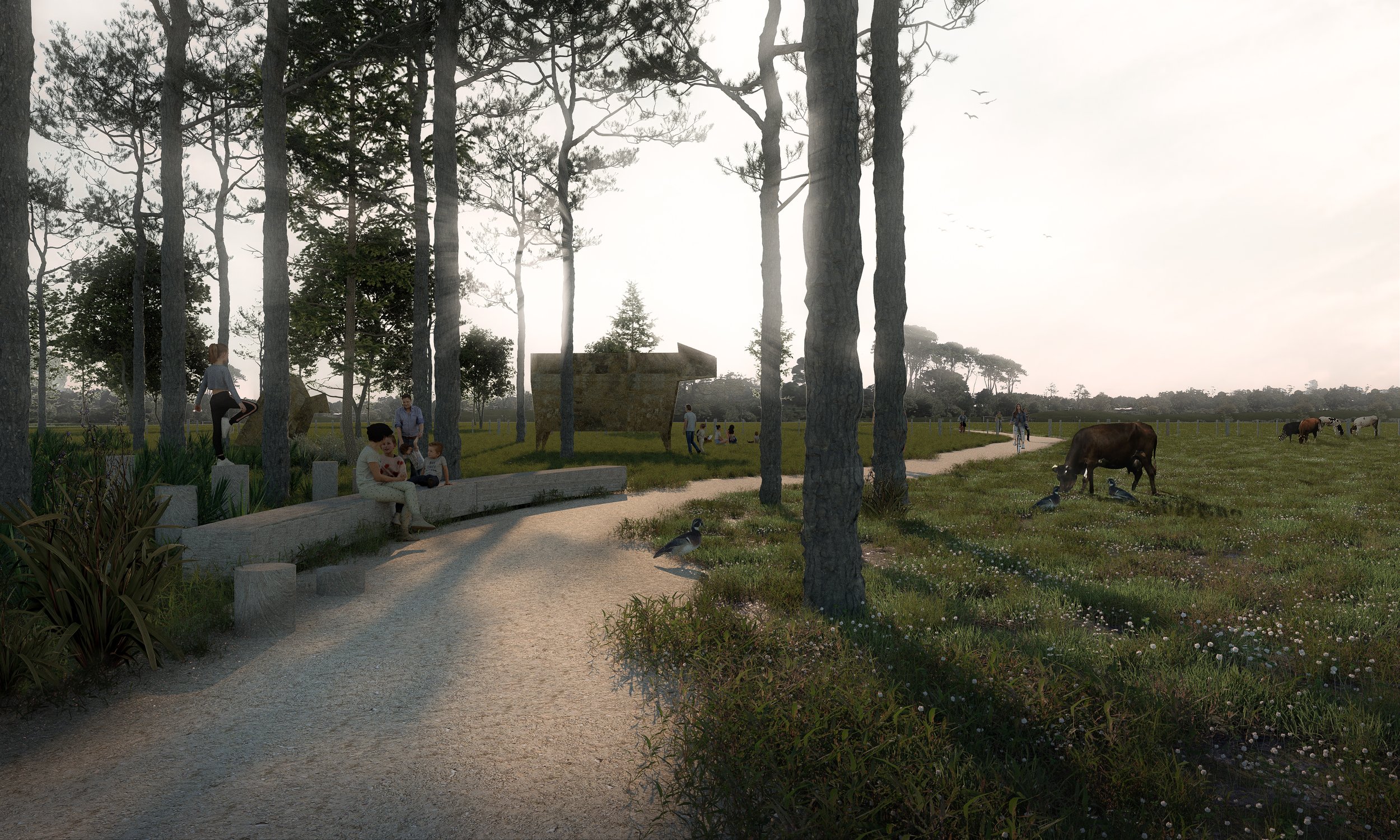
The masterplan capitalises on its rural edge condition by positioning landscape as both setting and infrastructure. A connected network of parks and open spaces integrates stormwater treatment, ecological restoration and recreational amenity. The four-village structure clusters community facilities, mixed-use centres and housing into walkable neighbourhoods embedded within this green framework.
Sustainability principles shape spatial form and performance. Green Star Communities and One Planet Living frameworks guide outcomes - embedding resilience, affordability and low-carbon living into the precinct’s DNA. Streets prioritise connectivity and pedestrian movement, reinforcing the settlement’s compact structure.
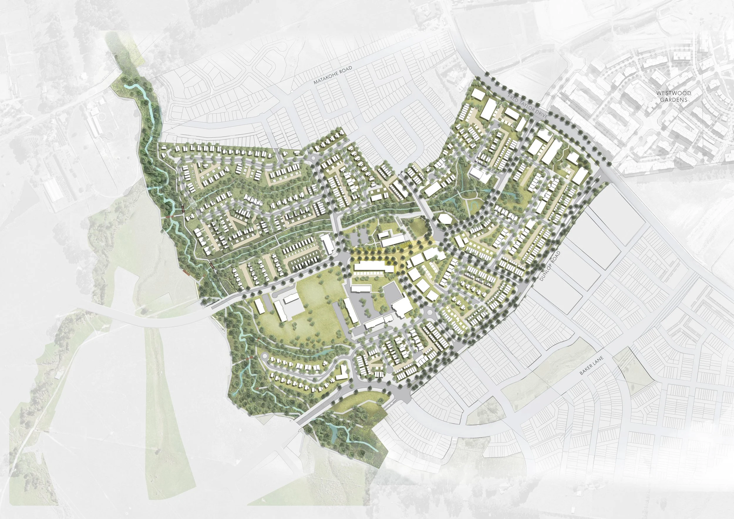
Raphoe Precinct (Stage 001) establishes a future-ready, socially connected and environmentally responsive village model - demonstrating how compact growth, landscape infrastructure and community life can operate as one integrated system.
Details
Budget
$200m
Collaborators
Cheshire Architects (Architecture) Harrison Grierson (Civil Engineering) Civil Plan (Planning)
2020 - Current
Date
Red Hills_ Tāmaki Makaurau - Auckland
Location
Hugh Green Group (HGG)
Client